


WHAT IS CIVILGRID?
CivilGrid centralizes utility, environmental, and geotechnical site data in an intuitive GIS platform
Access hundreds of data layers in a single map. Reduce project risk. Increase planning efficiency.
Site data to de-risk and accelerate due-diligence, engineering and construction.
Most comprehensive engineering and
construction project dataset.
Data securely hosted in the cloud and
accessible in real-time.
Information curated to meet real estate
and infrastructure project needs.
Data regularly updated by utility partners and
validated by users.
Access hundreds of data layers in a single map. Reduce project risk. Increase planning efficiency.
DATA
Utility Line Location
& Characteristics

Groundwater
Levels & Risks

Soil Type &
Conditions

Jurisdiction Information
& Permit Conditions

Environmental
Constraints

Reach out to us using our contact form, and we’ll answer all your questions!
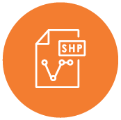
Download our Example Dataset with both Shape and DWG file types so you can see exactly what data you will have access to.

Start your 7-day free trial now. Search for your project location, browse available data, and delineate the project area.
USERS
Perform site due diligence and plan utility interconnects

Jumpstart your drawings with utility shapefiles, download known geotechnical findings

Gather bid or construction planning intelligence

Accelerate utility composite generation and improve your project planning

Aggregate and analyze projects in your municipality for improved project planning and permitting
VALUE
Reduce incidence
of dig-ins

Identify hazardous
ground conditions

Evaluate
cross-bore risk

Accelerate desktop
site due diligence
Automatically generate
utility composites

Identify local jurisdictions
& permit requirements

Save on drafting &
engineering time

Make potholing &
surveying smarter

Improve construction
estimating & planning
PARTNERSJoin our community as a Data Provider and get CivilGrid benefits.
Depending on the situation we provide payment, discounted platform access, or free platform access in exchange for your data. We also create
the opportunity for our community of users to peer validate your data.
Information You Can Provide:
As utility professionals, we understand the risks of data sharing and how to mitigate them.
That’s why our platform is built with:
CONTACTFill out the contact form below to request a demo or learn more about becoming a data partner


