We empower you to build, inspect & analyze the real world
effectively & efficiently.
Trusted to Save Time & Money for Innovative Organizations of All Sizes
A Complete Reality Capture Management System (RCMS)
SCHEDULEPRO SERVICES
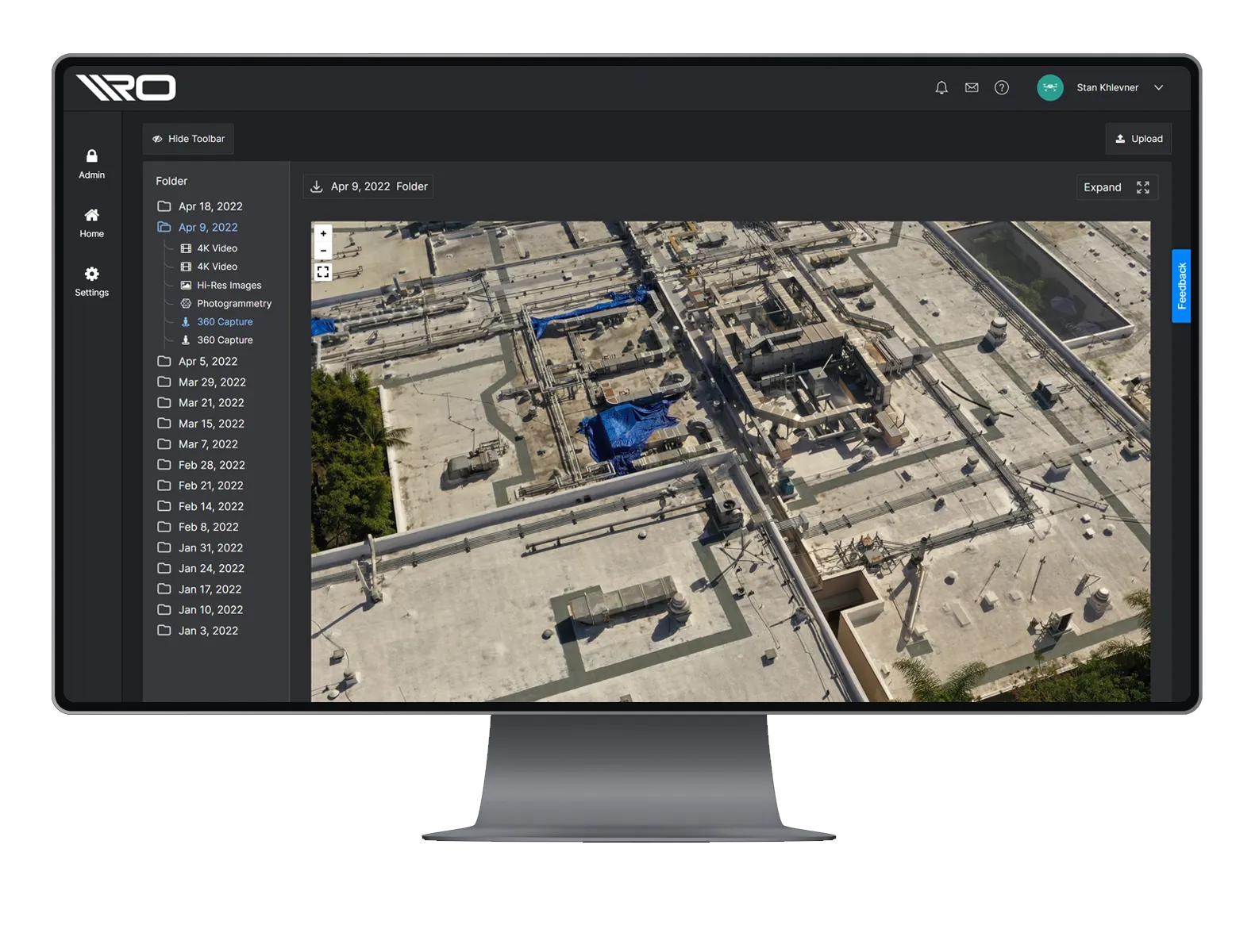
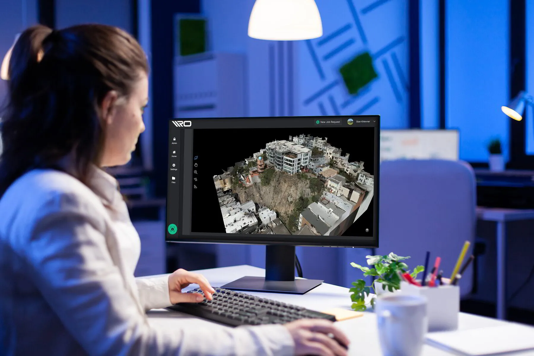
+ VIEW ALL YOUR DATA
INONE PLACE
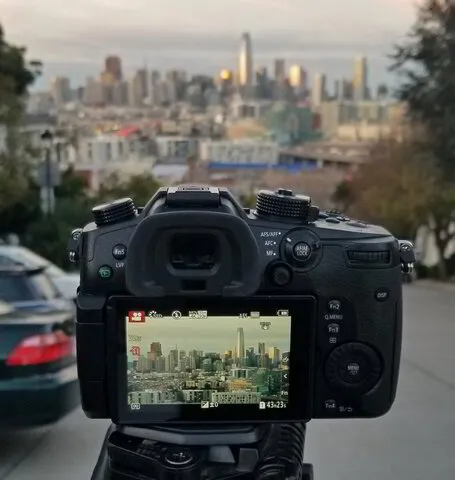
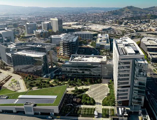
All your 2D & 3D geospatial data in a single web portal
Schedule on-off & routine data collections & inspections
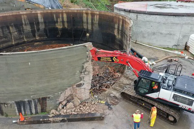
On demand, customized professional services
Unlimited users to your RCMS (Reality Capture Management System)
Easily share data internally & externally
A game-changing concept:
Reality Capture Management System (RCMS)
Collaboration works better when there is one, tailor-made place to store all your visual & geospatial assets.
For all your projects.
We understand how important collaboration can be to ensure workflows run smoothly throughout a project lifecycle. Now you can easily manage critical access to all your visual assets in one, cost-effective place. Bring in only your team, the entire company or selectively choose outside collaborators.
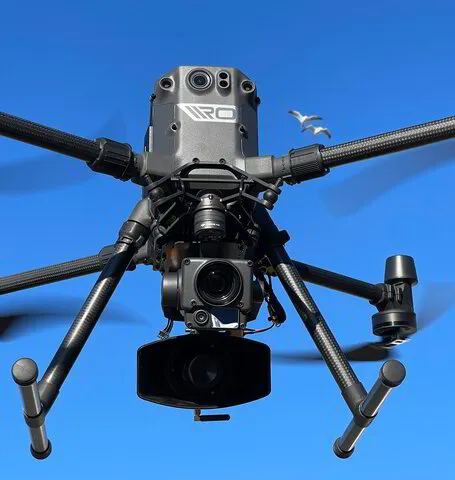
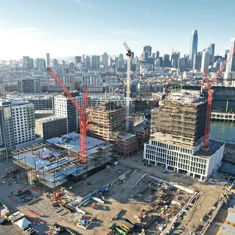
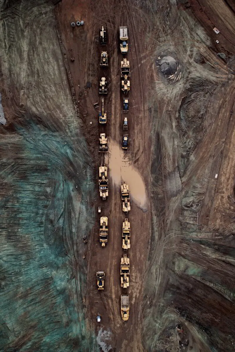
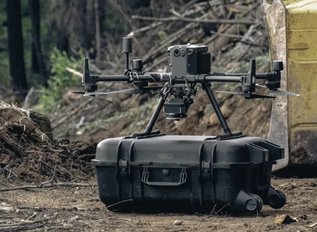
Drones
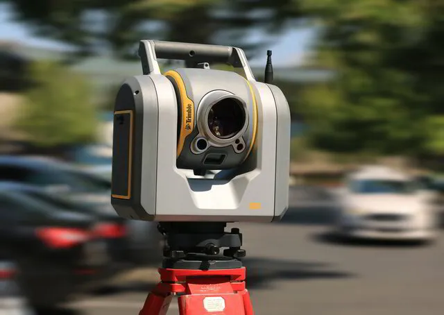
Laser Scanners
Hi-End Cameras
Schedule Pro Reality Capture Services
+
Visualize & Measure Deliverables Online
=
Hi-Res Images
High resolution static images used for everything from simple documentation to stitching complex orthomosaics.
4K+ Videos
Ultra high definition video files captured from a wide variety of aerial and ground-based sources.
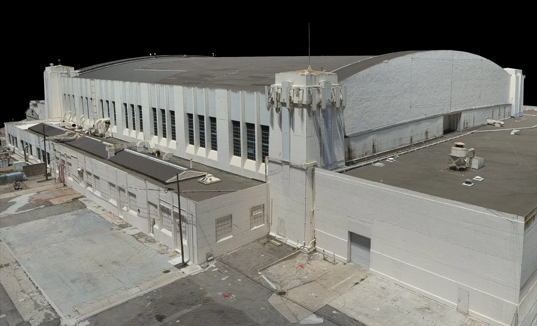
MasterMesh™
The highest fidelity form of visual 3D representation of the real world, all streamed through your browser.
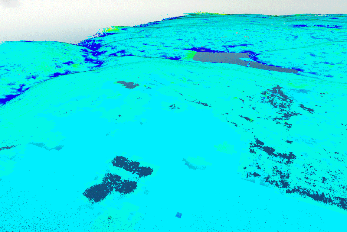
LiDAR Point Clouds
By representing spatial and color data as a collection of coordinate points, we can generate datasets for a wide array of processing applications.
Orthomosaics
A photogrammetrically orthorectified map mosaicked from a collection of overlapping images., where the geometric distortion has been corrected.
360 Images & Video
An easily controlled panoramic image or video that encompasses the point from which the media was taken. Exceptionally beneficial when viewed in virtual reality.
Surveyor-in-the-Loop Model
We partner with licensed land surveyors to provide PLS survey-quality work at the request of our customers.
ⓘ Remote Optix Inc. is not and does not represent itself as a Professional Licensed Surveyor or Licensed Engineer. We do not provide surveying or engineering services, but instead subcontract out any such work to appropriate 3rd parties. We provide earthwork estimating services and file conversion services for machine control model systems. All files converted are provided by licenses surveyors or engineers in their respective state.
MasterMesh™
Our innovative approach to creating 3D mesh models empower BIM, VDC, CAD and other tech teams to work with survey-grade models in the most cost-effective and direct way.
Accurate, precise, high-density 3D mesh models
Coordination-ready (Exportable to Revit & AutoCAD)
Sub 1cm GSD on most
Proprietary LiDAR + photogrammetry process
Multiple uses
Large, measurable as-builts
Historical preservation
Pre & post visualization modeling
Gaming assets and more...
Measurable Reality in Accurate 3D
Expertise Matters
By being software & hardware agnostic in our professional service operations, we prioritize getting our clients that data that matters most to their needs, in the most cost-effective way.
Digital Terrain Model (DTM) vs. Digital Surface Model (DSM)
Uncrewed Pro™
A Remote Optix Hardware Collaboration
With thousands of hours of real, in the field experience flying sUAS of all sizes comes a lot of first-hand knowledge. Turning that knowledge into useful hardware is what Uncrewed Pro™ is all about. Tools for sUAS professionals.
Coming Soon
Useful tool for sUAS professionals
Customized services for enterprise deployments & public safety use cases
User feedback always welcomed
The professional way to get your Reality Captured
Remote Optix offers a truly end-to-end solution for the majority of your reality capture needs. From simple photo and video documentation to complex inspections and surveyor-in-the-loop topographic survey work, we not only get you the data you need, but we also offer a place to visualize and measure that data for your internal teams and any outside collaborators.
If you want dependable & repeatable results, work with professionals that know what they're doing and value your time.
Dependable ROI
By working with an end-to-end data capture solution that is flexible and knowledgeable, your ROI can be immediate and easily justifiable.
Remote Optix a software and professional services company bringing tech-enabled reality capture solutions to the construction, civil engineering, commercial real estate and industrial inspection industries.