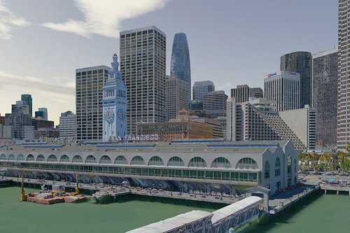
Aerometrex provides its global client base a range of sophisticated 3D reality modeling products and services based on advanced photogrammetric and visualization techniques.
We have built a very strong national and international reputation as a leading practitioner of these services. We are known and trusted by government departments at all levels as well as major private sector corporations across a range of industries.
Our award-winning 3D modeling service provides an end-to-end solution from flight planning to 3D processing and geo-registration.
We design surveys based on end-user needs. We combine imagery from fixed-wing aircraft, helicopters, and street-level to build accurate 3D reality mesh models.
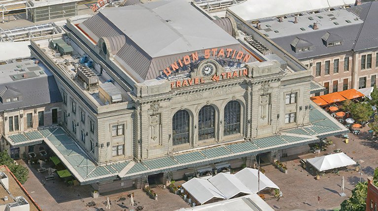
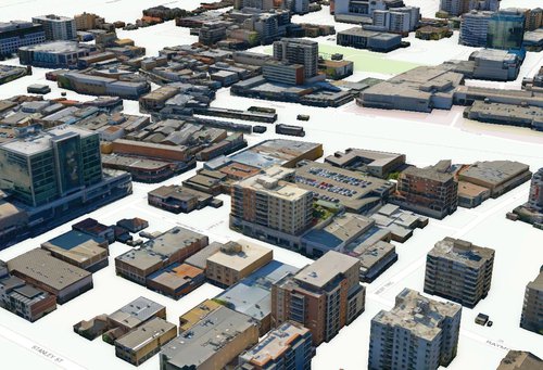
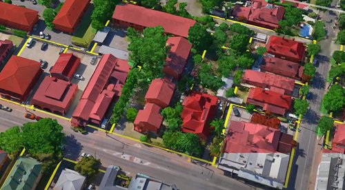
Our 3D Reality Mesh Models are a multi-industry and multi-use solution for visualizing, managing, and monitoring changes to 3D spaces. We deliver high-resolution 3D models, enhanced with precise measurement, and accurate geolocation. Our data provides context to your projects, helps develop and visualize scenarios, and offers a comprehensive base dataset for change monitoring.
You can purchase from our range of pre-captured datasets or tailor your capture to be exactly what you want:
All our mesh models start with high-quality aerial captures so your model is detailed, accurate, and true-to-life. They are a valuable asset with the possibility to interact and extract real 3D information in both natural and built environments.
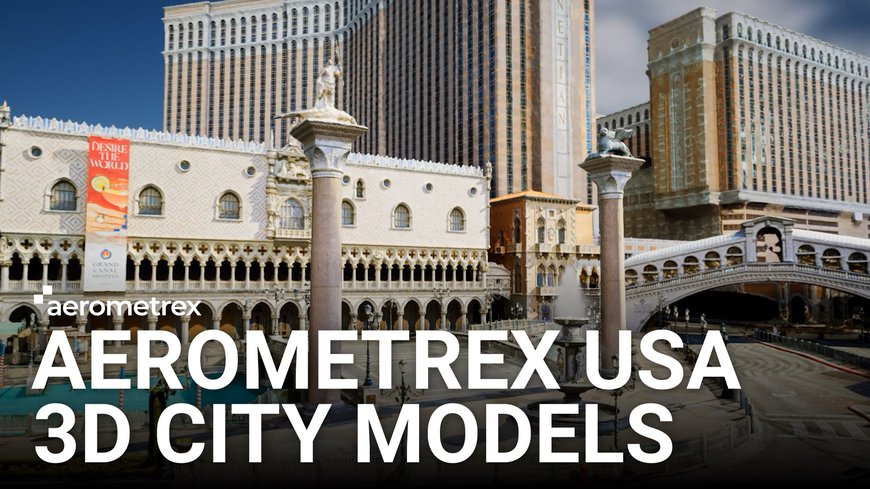
Take a look at our full range of 3D photogrammetry models from across the USA.
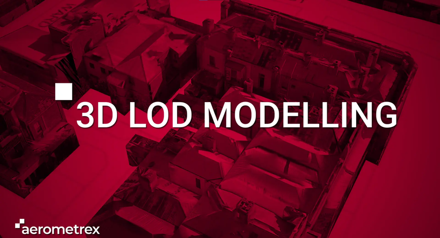
Level of Detail (LOD) models are representations of buildings at different scalable detail. We have multiple options for LOD models depending on client needs. The options below are a guide and we can add more details.
LOD models are valuable for asset management, project visualizations, and planning purposes. Users can see and isolate all buildings within environments, view any data attached to the building model, and turn them off if needed. We've developed a system in-house to wrap the building models with photogrammetry to precisely render every individual model. That gives real-world texture to the LOD models and makes them a better representation of the real world.
Stuart Wileman and Tristan Brown from our Production team talk about Level of Detail (LOD) modeling and how it can be used to provide a detailed dataset for planning and visualization.
We are at the forefront of developing 3D visualizations for a range of projects. Our team has been working on ways to streamline large-scale 3D model ingestion for game engines, which offer the ultimate in real-time model visualizations for various industries.
Dynamic lighting, realistic weather, and photogrammetry asset libraries make for a rich and diverse staging environment that can change to reflect real-world conditions. An architectural firm can re-create a fully-furnished apartment building and show real-world lighting to prospective buyers who can digitally walk through the property. Housing developments can model an entire neighborhood before it’s built and let people experience the space in virtual reality. Large infrastructure projects can place new structures within a city model and show a bridge or building as it will exist in the real world.
Our street-level enhanced multi-scale 3D mesh models are ideal for loading into game engines like Unreal Engine, Unity, or the architectural visualization platform Twinmotion.
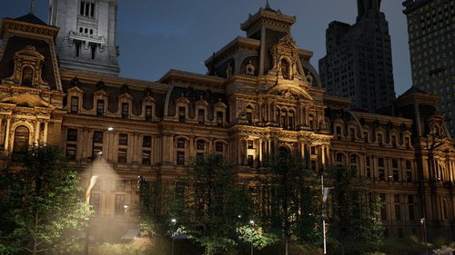
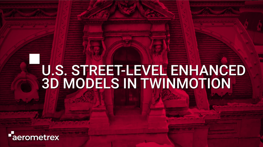
We ingested our multi-scale 3D city models into Twinmotion to create virtual fly throughs with dynamic lighting, character models, vehicle models, and weather effects to make immersive experiences.
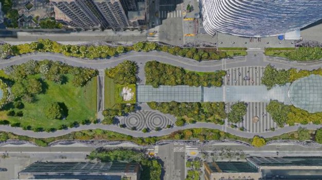
Artificial Intelligence and Machine Learning enable the classification of 3D reality mesh and allow for intuitive management of data that’s grounded in accurate renders of real-world spaces. They simplify the management of Smart Cities where ordinary objects will hold extraordinary abilities. Classified mesh models are the ultimate city data management tool that mixes high-quality imagery, attribute data, and interactivity.
We start with a high-resolution capture of an urban area. We use a mixture of aerial and ground imagery with oblique photogrammetry as the basis of a realistic 3D mesh model. We use a mixture of manual and AI-driven processes to classify objects as buildings, trees, and others chosen by the customer. Each classified object can then have databased information applied to it. Interactive 3D GIS solutions allow users to interact with and query the integrated classified 3D data.
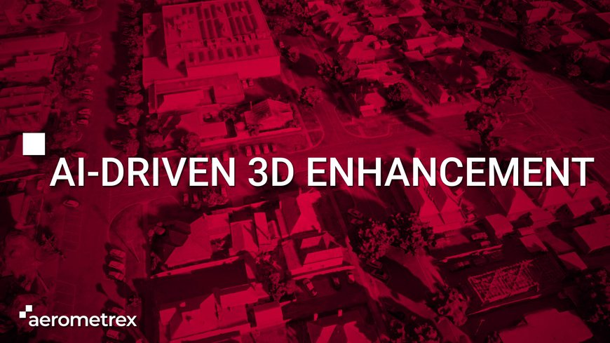
Our AI-driven processes let us enhance 3D models for different visualizations. This example video shows how we used AI to recognise and replace all of the trees in a 3D model with game assets.
Our 3D Reality Mesh Models are a multi-industry and multi-use solution for visualizing, managing, and monitoring changes to 3D spaces. We deliver high-resolution 3D models, enhanced with precise measurement, and accurate geolocation. Our data provides context to your projects, helps develop and visualize scenarios, and offers a comprehensive base dataset for change monitoring.
You can purchase from our range of pre-captured datasets or tailor your capture to be exactly what you want:
All our mesh models start with high-quality aerial captures so your model is detailed, accurate, and true-to-life. They are a valuable asset with the possibility to interact and extract real 3D information in both natural and built environments.
Take a look at our full range of 3D photogrammetry models from across the USA.
Level of Detail (LOD) models are representations of buildings at different scalable detail. We have multiple options for LOD models depending on client needs. The options below are a guide and we can add more details.
LOD models are valuable for asset management, project visualizations, and planning purposes. Users can see and isolate all buildings within environments, view any data attached to the building model, and turn them off if needed. We've developed a system in-house to wrap the building models with photogrammetry to precisely render every individual model. That gives real-world texture to the LOD models and makes them a better representation of the real world.
Stuart Wileman and Tristan Brown from our Production team talk about Level of Detail (LOD) modeling and how it can be used to provide a detailed dataset for planning and visualization.
We are at the forefront of developing 3D visualizations for a range of projects. Our team has been working on ways to streamline large-scale 3D model ingestion for game engines, which offer the ultimate in real-time model visualizations for various industries.
Dynamic lighting, realistic weather, and photogrammetry asset libraries make for a rich and diverse staging environment that can change to reflect real-world conditions. An architectural firm can re-create a fully-furnished apartment building and show real-world lighting to prospective buyers who can digitally walk through the property. Housing developments can model an entire neighborhood before it’s built and let people experience the space in virtual reality. Large infrastructure projects can place new structures within a city model and show a bridge or building as it will exist in the real world.
Our street-level enhanced multi-scale 3D mesh models are ideal for loading into game engines like Unreal Engine, Unity, or the architectural visualization platform Twinmotion.
We ingested our multi-scale 3D city models into Twinmotion to create virtual fly throughs with dynamic lighting, character models, vehicle models, and weather effects to make immersive experiences.
Artificial Intelligence and Machine Learning enable the classification of 3D reality mesh and allow for intuitive management of data that’s grounded in accurate renders of real-world spaces. They simplify the management of Smart Cities where ordinary objects will hold extraordinary abilities. Classified mesh models are the ultimate city data management tool that mixes high-quality imagery, attribute data, and interactivity.
We start with a high-resolution capture of an urban area. We use a mixture of aerial and ground imagery with oblique photogrammetry as the basis of a realistic 3D mesh model. We use a mixture of manual and AI-driven processes to classify objects as buildings, trees, and others chosen by the customer. Each classified object can then have databased information applied to it. Interactive 3D GIS solutions allow users to interact with and query the integrated classified 3D data.
Our AI-driven processes let us enhance 3D models for different visualizations. This example video shows how we used AI to recognise and replace all of the trees in a 3D model with game assets.
Experience Aerometrex 3D by downloading samples of our recent Denver 3D model in 2cm, 5cm and Street-level resolution in OBJ, FBX, 3DTiles or SLPK formats.